Day 9 - Trails and Navigation
April 14, 2017
Segment: Government Camp to near Paradise Park, 9.5 miles.
Weather: High 50 degrees, mostly cloudy with snow and rain.
Weeks had gone into planning and adjusting this route. Personal interruptions and lack of weather windows kept me off trail for weeks. I watched reports of rising temps and snow changing to rain. Now, as we approached Government Camp (at the base of Mt. Hood) from the east I was nervous as I saw only patches of snow. Finally, cresting over 4000 feet towards the west side, the ground became fully covered.
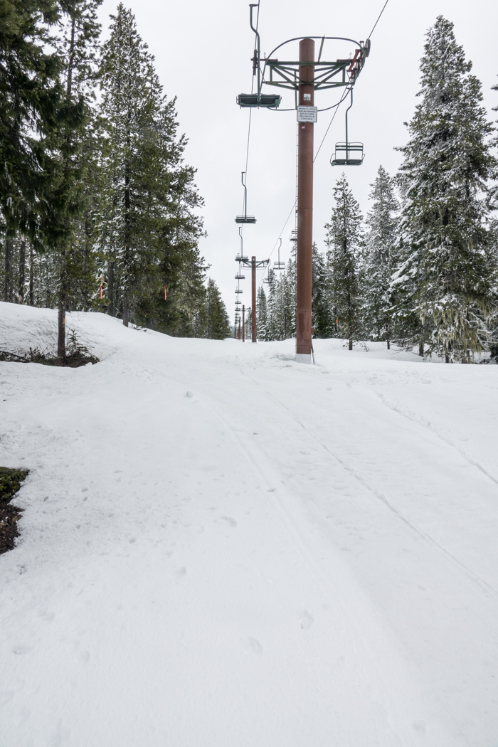
With a hug and a kiss and a group picture with Rhonda—my wife—and Angela—my daughter—I took off up the ski hill from highway 26. The sun had turned to gray and now turned to snow as I began a circuitous route above and around the little resort area.

The easy way to climb a hill!
In spite of the gray, and in spite of the off and on big flakes, it felt good to be back out on the slopes. God calls us to come apart and rest awhile, and continuous mild exercise in fresh air is actually quite relaxing and invigorating. My back stiffens at the desk, but loosens in the mountains.
Navigating down meltwater streams to bridges and then along a network of trails, I descended westward from 4000 to under 3000 feet. There I found the snow entirely melted—not a patch anywhere. I carried my skis along a road to the Paradise Park trailhead. I was well above 3000 feet on the south facing foot of the ridge before there was enough snow to allow me to put my skis back on.

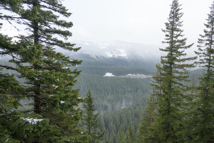
Looking back southeast to hwy 26 from Paradise Park trail
Because of the late start (after 1pm), the day soon came to an end. This was on purpose. I tend to get over-excited the first day out and push myself beyond what my body is prepared to handle. I decided to use a half day to “warm up.” Below Paradise Park I set up camp in preparation for turning west the next day.
Today I thank God for bridges and for feeling good!
Navigation
Because of the short day and ugly weather, this seems like a good place to mention a few cautions about navigation, something I have wanted to comment on for a while.
Before starting this Oregon Crest Ski trip, I looked for someone who had done something similar and could not find anyone. As far as I know, I am the first one to do this type of solo trip and blog about it. Therefore, I am conscious of setting a good example and sharing what I learn. I consider myself intermediate, certainly not expert and definitely not professional.
I think the chief characteristic that enables me to do this is having an innate sense of direction and navigating. Even when I cannot figure out south on a gray day, I can pick a direction and hold to it fairly well. This is important when navigating a sea of white snow that has no permanent tracks. The buried trails are built for summer hiking, not for winter skiing.
If you don’t feel comfortable exploring where no one has gone before and blazing your own way from self-chosen landmark to self-chosen landmark, then please don’t try a trip like this. You will get lost, or at least discouraged, and possibly panicked. When precipitation is falling and landmarks disappear, you must maintain your direction or stop. (I am assuming safe terrain during this whole discussion.)
As you have read in previous posts, sometimes it is good to follow the path and markers on the trees, and at other times it is better to set off on a safer route to a different destination or to rejoin the trail later. Of course, that only works if you are experienced with map reading and have a working GPS. Setting the GPS in trail marking mode I think is better than using its compass mode alone, because you can see your previous track and can turn around to compare to the landscape. Also, you have a better idea of where you are headed.
If your GPS stops working on a backcountry ski trip, then I would say it is time to use the compass and paper map to get yourself to a safe exit, which you plan ahead of time and always adjust on an hourly basis. No sleeping at the wheel in the snow covered mountains! A compass will not get you to a specific point, only in a general direction. Aim for a road that leads down and out.
This means you must always know where you are at. By this I mean you must always know where you are in relation to your surroundings. You are always traveling through a context.
Are the ridges parallel or radiating outward from a mountain peak? Is it better to exit east or west? Is straight down safer than slowly descending down the ridge? Are there stream crossings ahead? (I need to get decent pictures of the tiny but dangerous canyons that even small streams carve.) Are there frozen lakes that might break under your weight? Are the ridges open (like in southern Oregon) or are they steep, narrow, and tree covered (like in northern Oregon)? Will the night air be dry and breezey, or will it be damp and still?
I avoid crossing big open slopes above 25 degrees without trees, because of avalanche risk. (Put your poles at right angles, handle to handle, then slide the horizontal pole downward. If it hits the snow before halfway down the vertical, then the slope is more than 25 degrees.) I avoid crossing icy slopes by trying to time them for an afternoon crossing when they warm up and give traction. Of course, that is negated if the snow is still layered.
There is a lot to winter navigating. The skier must watch the weather, the direction, the terrain, the body, the time, the map, and the Guide. I would not attempt a trip without all of these. Especially I think it is crucial to listen to the premonitions and convictions of the Spirit because there are always unknowns, even to the most well-planned trip under the most gentle conditions. God is our vision over the horizon.
Another important ingredient is experience. For years I have ventured off trail under a variety of conditions in a variety of seasons and then tried to hit my origin point within a hundred yards—using nothing or just a compass. I cannot over emphasize that there are no trails in winter. Signs are encouraging waypoints, but you are on your own just one foot past them.
Be safe. Be wise. Stay within your limits. Your limits will grow, but there is always something out there beyond them. Above all, enjoy, and may God go with you!
